Travel
Cruze-N
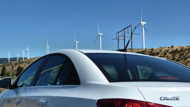
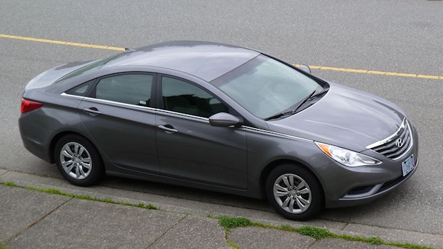
Our rental car for the past nine days was a Chevy Cruze and it was a pleasant surprise. The seats were leather covered with built in heaters (nice in the cool northwest, but we only used them once to test them), were very comfortable and reasonably supportive. The steering was weighted nicely, plus the wheel was fat and also leather covered. Response was peppy enough and the automatic transmission was geared pretty well, seldom left hunting for just the right one. The trunk swallowed our large suitcase, two carry-ons and a laptop bag with plenty of room for any impulse souvenir purchases. I noticed only a couple of short comings, limited rear legroom with tall front seat occupants and the interior could be noisy at speed, but nothing more than expected at this size and price point.
In almost all two lane driving, with plenty of ups and downs, twisty road coast roads and slow small town driving the car returned a very nice 32.9 MPG. We drove 1624 miles and spent a total of $191, using 49.3 gallons of gas. The cheapest regular gas was $3.719 in Florence, OR and the most expensive was $4.049 in Smith River, CA. The average cost per gallon for the trip was $3.875.
Tillamook, WA to SeaTac
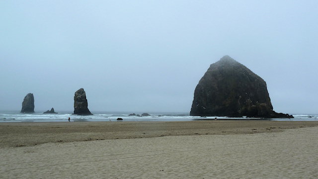
We stopped at Cannon Beach and unlike our last visit, the weather was foggy and cold. Also unlike our last visit we were armed with a GPSr. We nabbed a couple geocaches for souvenirs this time.
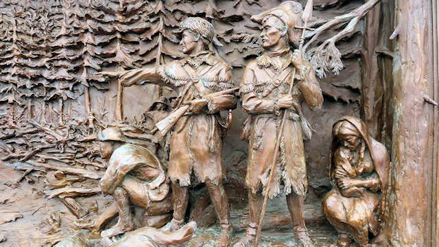
Lewis and Clark were stuck here just on the Washington side of the Columbia River opposite Astoria in a howling winter storm with no food for almost a week, so they named it a dismal nitch. We called it a dismal nitch because we had to put our coats on to walk the 1/4 mile to a geocache. We obviously have a very different comfort level in 2011 than they did in 1805.
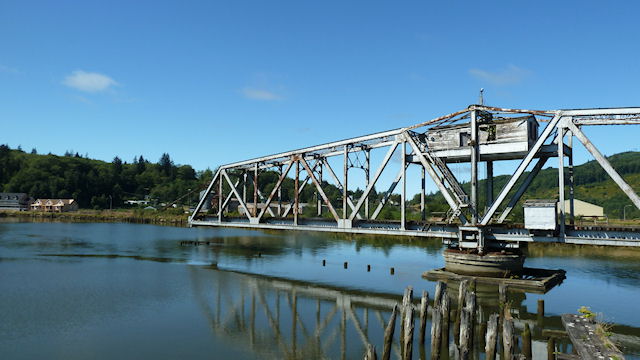
Here is a picture of one half of one of the last standing movable bridges in Washington State, the Raymond steel swing bridge, crossing the Willapa River. The other half (of the picture, not the bridge) was lost due to my unfamiliarity with the camera’s panorama function.
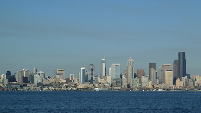
The view from our seats at Salty’s On Alki restaurant where we ate our last vacation style (read, expensive) meal before turning in the rental car and shuttling to the airport.
The Power Of Cheese
Today was a “rest day” as we stayed in the same hotel for a second night. We did a little exploring in the area. Tomorrow we have 250 miles to get to SeaTac to catch a plane home and about 13 hours to get there, so hopefully even with Labor Day traffic we’ll get there in time.
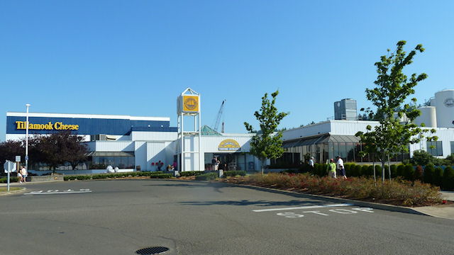
First stop was the famous Tillamook Cheese Factory. There is a self guided tour with history and such, plus an observation deck so you can watch cheese being packaged. There was also a line where you could taste the cheese for free, but it was too long, so rather than wait we bought a sample package for three bucks in the gift shop.
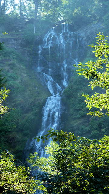
Just south of town was a small state park that showcased a 319′ waterfall. The trail was closed short of allowing you to get to the base of Munson Creek Falls, not because they didn’t want you there, but because many large trees have fallen blocking the way.
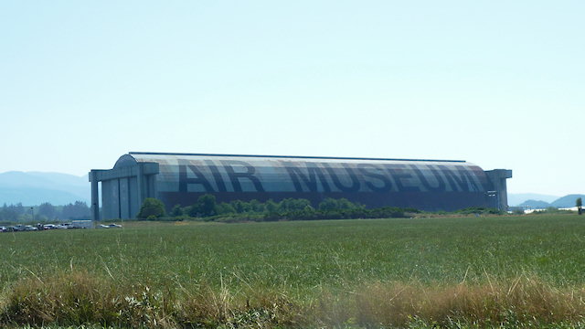
The one place we paid to get into today was the Tillamook Air Museum and it was well worth it. It is housed in the one remaining blimp hangers built here for coastal defense during World War Two. The air museum inside has many interesting aircraft and a ton of WWII memorabilia.
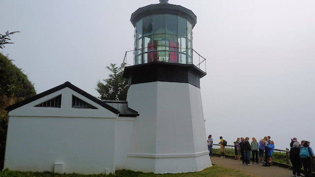
In the late afternoon we headed out to Cape Meares to get dinner at one of the small towns on the coast there and catch a sunset over the Pacific. We managed one of two. Dinner was at a small cafe in Oceanside, but the sunset was called on account of the fog rolling in. All that white space to the right of the 38′ tall Cape Meares Lighthouse would be the blue of the sky and water, but for the fog that blanketed the peninsula.
Florence, OR to Tillamook, OR
After breakfast we headed a couple miles south (backwards) to poke around one of the dune parks. From the parking areas it is about 50 foot climb up to the top of the dune and then 50 feet down done to the beach. For a sense of scale, that spot about halfway down from the top at about the left 1/3 of the photo is a person climbing up the dune.
There are sections of the park set aside just for off-roading. These purpose built quads sit at the top of the dune watching several others do the hill climb thing.
The Heceta Head Lighthouse is normally open for tours, but is being restored,so we had to settle for a photograph of it from an overlook on the other side of the bay.
This photo was from a stone shelter built in the ’30s at the end of the the St. Perpetua Trail. The trail is 1.3 miles long one way and climbs 830′ from the Visitor’s Center to the shelter on the tallest place on the Oregon coast.
Crescent City, CA to Florence, OR
We started the day amongst the coastal northern California’s tall trees…
Which quickly turned into southern Oregon’s rocky coast…
And ended up at central Oregon’s sand dune filled coast.
Crater Lake, OR to Crescent City, CA
We we got up this morning there was frost on the car which was not unexpected at 6000′ and 35°. On the drive up we passed several spots that still had snow on the ground left over from the park’s 44 foot annual accumulation.
While walking around the Mazama Village where we were staying there were numerous tall sticks lining the roadway. These are there so the snow plows know where to clear. At the top (where the red dot is) is a bit of reflective tape to help the drivers pick them out.
This our home for tonight, Casa Rubio. It is right on the beach. What made it even better was there as a restaurant about a 100 yards away that we could walk to and the food was fantastic. We were so close to the Oregon/California border, about 800 feet, if Oregon were to invade California this would be the first line of defense.