On yesterday’s day trip to Ashland, we went west on a couple county roads, Clover Creek Road and Dead Indian Memorial Road instead of the slightly shorter, but longer time way of OR-66 because both Google and the Garmin recommended it. To get to Ashland you have to go up and over the Cascades. Klamath Falls sits at 4100′ above sea level and on the way over we hit altitudes of around 5,500 feet. The Clover Creek Road section out of Klamath Falls climbs easily and steadily to the plateau section that hovers at about a mile high. After about 33 miles you turn left on Dead Indian Memorial Road and in short order you cross the Pacific Crest Trail. The road settles into a smooth run through ranches and by small lakes until you hit the last 20 miles where you drop down a couple thousand feet of elevation. But unlike in the east, the open land allows a more shallow drop per mile traveled, most of the way down is in 4th gear with occasional foray into 3rd gear.
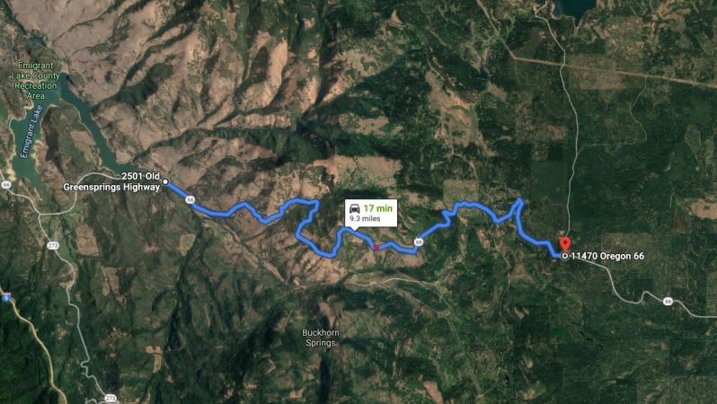
On the way home, we opted to try OR-66 because I kind of wanted to avoid the same road when going back. So the road profile is similar, just backwards, the 2,000′ climb is at the start, then plateau, then a shallower 1,300′ descent at the end. The Google map image above shows the approximate ascent. It is no Deals Gap, for one it is not really flat, it is a hill climb. And I didn’t count the turns, but there were probably about half the number as on the Tail of the Dragon, but I drove this road a lot slower than I do the dragon for a couple of reasons. The first is familiarity, we started going to drive the Gap in 1997, and in those intervening 22 years I’ve probably traveled that road a hundred times in one direction. The other is, on about 60% of the climb up on OR-66 there is no guardrail. And on the way up you are on the outside lane of the mountain! I don’t know about you, but I am not really afraid of heights, I am just not comfortable at all while at the edge of those heights. My testicles were residing somewhere up in my abdomen for a lot of the drive up.
If you look at the Google map again it says that stretch of road is 9.3 miles and it should take you 17 minutes. That averages out to be just under 34 MPH, I bet my average was more like 30 MPH. Now we were in the Mini, so when I get to drive the Miata and I’ve done it a few times that average speed will be reduced a bit. But I probably won’t get it below the Google estimate until I’m in the Miata and I’m going down on in the other where I’ll be up against the mountain not the edge…

